THE BOOK
Some of the ideas discussed in this blog are published in my new book called "The Stonehenge Bluestones" -- available by post and through good bookshops everywhere. Bad bookshops might not have it....
To order, click
HERE

Monday 20 December 2010

Periglacial landscape change -- Eastern England


These photos show the impact that permafrost conditions can have in a landscape of chalk substrate and chalky till.

Above:  low level aerial photo of ice-wedge polygons near Colne, Hunts.  These are formed on terrace gravels of the Great Ouse River.  The gravels are supposedly of Devensian age, which means that the polygons themselves must be of late-glacial age -- maybe 13,000 - 10,000 years old.


Below:  remnants of pingos on east Walton Common, Norfolk.  The soil is on cryoturbated chalk.  The complex pattern of hollows and ridges shows that there must have been many "segregated ice masses" here during a prolonged period of permafrost conditions.

Why do features like these not exist in the chalk downlands further west?  Williams and others have suggested that the permafrost was maybe not so intense or prolonged as it was further east.  So in Norfolk and Huntingdon, on low-lying land with very low gradients, there was very little summer thawing and a thin active layer, with ice wedges and segregated ice masses able to form and survive and grow.  Further west, under greater influence from moisture-bearing westerly winds, maybe the temperature was a degree or two warmer, with less intense frost action.  Also, because the altitude is greater (mostly over 100m on Salisbury Plain, as against land surfaces mostly under 30m in the east) the water table was deeper beneath the surface and maybe large areas were affected by "dry permafrost".  Because of steeper slopes in and around the coombes, solifluction processes (leading to the accumulation of thick "head" deposits) were relatively more important.

Sunday 19 December 2010

Why is Salisbury Plain different?


 The lower map (with a rather inaccurate Devensian ice limit shown on it) shows chalkland patterns (black dots), ice wedges (inverted triangles), ice wedge polygons (diamonds), involutions (squares) and stone polygons and stripes (circles).  (Richard West, 1968)

What interests me most from the info contained in the last couple of posts is this:  Why are the western downs (including Salisbury Plain) so different, in terms of their superficial geology and geomorphology, from those of eastern England? 

During the Pleistocene the Chalk to the north and east of Buckinghamshire was directly eroded by ice sheets in most parts of the Eastern region, and its surface layer was disturbed by frost action. Today the Chalk is mantled by a veneer of superficial  deposits such as glacial till (sometimes called the "Chalky boulder-clay) and erosional residues such as clay-with-flints.  There are also many traces of periglacial action (involutions, frost heave features, patterned ground including polygons, and even fossil pingos.)  These attest to a prolonged period of permafrost which had a dramatic effect on the ground surface.  There are even thermokarst features, associated with surface collapse following the melting of subsurface ice masses.  There are also more frequent solution features including sink holes, dolines and ponds.

The lower map above shows a high concentration of these permafrost features in Eastern England -- for example, in Norfolk and Kent.  On the other hand these features are very sparse in Wiltshire, on  the Downs.   Why?  If all of these chalk areas lay outside the limit of Devensian ice, we might expect similar traces of prolonged permafrost on all of them.  So were the abundant features in the east down to the presence there of chalky till and other sediments above the chalk -- in contrast to the relatively thin soils of the Wiltshire Downs?  Or is the difference down to the TYPE of permafrost?  Could it have been "wet" permafrost in the east, with higher water tables and a permafrost table close to the ground surface, as distinct from "dry" permafrost in the west?  One might speculate that a lower water table in the west, maybe because of the higher altitude of the Wiltshire Downs,  led to less activity in the surface zone of seasonal thawing and refreezing -- leading in turn to the formation of far fewer permafrost features.......

Something to think about.

Geology of the Wiltshire Downs

Geology of the Wiltshire Downs (from Natural England site)

Dominating almost two thirds of Wiltshire ...... is the Upper Cretaceous Chalk which forms the vast rolling landscape of Salisbury Plain with its seemingly endless arable fields and unimproved grassland punctuated only by small hilltop woodlands. During the Tertiary and Quaternary, erosion and weathering of the chalk produced the clay-with-flints deposits that occur across parts of the plateau surface and which today often support woodland vegetation, in contrast to the thin, dry soils of the Chalk. Scattered across the Plain and the downs are Sarsen stones, the weather-worn blocks of grey sandstone derived from the former cover of Tertiary deposits.

Cretaceous

Though freshwater and terrestrial conditions continued through into the early Cretaceous once more sea-level rose and there was a return to shallow marine conditions. This is marked in Wiltshire by the sands and ironstones of the Lower Greensand, which outcrop in the Vale of Wardour and in the Vale of Pewsey to the west of Devizes. Ironstone within a small outcrop of the Lower Greensand at Seend was formerly quarried and the ore smelted on the spot.
The Lower Greensand is succeeded by the Gault Clay and the Upper Greensand, their outcrop zigzagging in a narrow strip around the edge of the Chalk escarpment and flooring the Vale of Pewsey east of Devizes. Exposures of the bluish-grey Gault Clay are rare, but quarries in the Upper Greensand near Warminster show that the warm, sub-tropical sea in which it was deposited teemed with life as large numbers of fossil bivalves, sea-urchins and ammonites can be found. In the south-west of the County, the Upper Greensand outcrop gives rise to an undulating, hilly landscape. The rounded hills and relatively free-draining and slightly acidic soils provide the attractive setting for the historic parks of Stourhead and Longleat.
The transition to the overlying Chalk can be observed in several old quarries located at the base of the scarp slope that dominates the skyline in much of west and north Wiltshire.

This leads up onto the large chalk plateau of Salisbury Plain which dominates the centre of the County, Cranborne Chase in the south and the Marlborough Downs in the north. The very pure limestone (up to 98% calcium carbonate) of the Chalk was deposited in a warm shallow tropical sea around 70-100 million years ago. Despite its extensive outcrop, natural exposures are not common, but it can be seen in road cuttings and old quarries such as those at Harnham just to the south of Salisbury. Throughout its area of outcrop, wherever agricultural practice is suitable, the chalk supports calcareous grassland vegetation that is rich in many plant species including orchids and herbs.

Tertiary (comprising Neogene and Palaeogene)

The main outcrop of Tertiary (65-2 million years ago) rocks occurs in the south-eastern corner of the County. These outcrop in a narrow belt to the north of Dean Hill in a shallow basin that forms a small extension of the much larger Tertiary Hampshire Basin to the south. There is also a small outcrop of Tertiary sediments at Great Bedwyn and Savernake Forest south-east of Marlborough at the far western end of the London Basin. These various clays and sands were laid down in shallow marine, coastal and fluvial (river) environments and include the Upnor Formation, Reading Formation, London Clay and Bracklesham Group.
Sarsen stones, isolated remnant blocks of weathered Tertiary sandstone with a hard silica cement, can be found over the surface of the chalk. These probably represent outlying deposits of sands within the Reading Formation and indicate that these Tertiary sediments formerly extended well beyond their present more limited outcrop. Cementation of the sands probably occurred just below the ground surface under an arid or semi-arid climate, perhaps 5-10 million years ago, and the surrounding uncemented sediments have long since been washed away. In some areas the surface of the chalk is covered by clay-with-flints. This represents the insoluble residue left after chalk has been eroded and weathered away, and has probably been formed over many millions of years. The clay-with-flints often gives rise to more acidic soil conditions which contrasts with the calcareous soils derived directly from the chalk bedrock.

Quaternary

Over the last two million years the climate of Britain has varied tremendously with periods of temperate climate interrupted by repeated advances and retreats of glaciers and ice sheets. Collectively these periods have become known as the Ice Age (we are still in one of the temperate phases) and the actions of the ice sheets and the climatic changes have been instrumental in forming the landscape we see today.
Ice did not reach Wiltshire during the Quaternary, although tundra-like conditions would have prevailed. Under these arctic conditions the dry valleys of the chalk probably formed. These features occur on what is a very permeable rock which does not generally support surface drainage systems. However, during the various glacial periods, deep permafrost would have made the ground impermeable and allowed gradual erosion of the frozen soil surface to occur, particularly during summer thaws. Much of the shaping of the present form of the Chalk landscape with its scarps, dip-slopes and valleys would have been produced through water erosion.

+++++++++++++++++++++++++++++++

Some detail about the Chalk layers (acknowledgement to Wilts Geology Group):
ww.wiltsgeology.org.uk/
 
The beds of the Chalk formation build some of the most spectacular scarp and downland scenery in Wiltshire. Mineralogically the transition from the Upper Greensand to Grey (Lower) Chalk is gradual, the basal beds being very sandy and glauconitic. These levels include the famous Warminster Greensand and the Cenomanian Basement Bed or Glauconitic Marl, (both these beds are now incorporated as the Melbury Sandstone).
"Proper" Chalk begins with the Zig Zag Chalk Member, which forms the basal third of the escarpment around Salisbury Plain. The lower beds have a grey appearance due to a silt content, but the chalk gradually whitens and becomes more massive upwards in the section known as the Plenus Marls, after a characteristic belemnite.
The base of the White (Middle and Upper) Chalk occurs at a hard nodular band known as the Melbourn Rock, whilst the remainder of the formation, 20 to 40 metres thick, is divided into the Holywell Nodular Chalk Member and the New Pit Chalk Member.
In the highest levels of the outcrop flints become common. The Lewes Nodular Chalk Formation caps the highest escarpments. At its base, the Chalk Rock is rich in glauconitised/phosphatised erosion surfaces (hardgrounds), four in the outcrop on White Sheet Hill. The topmost members of the White Chalk, some 60m thick, are typical firm, white chalk with regular courses of flint nodules.


Understanding the Downland Landscape

My next project is to try and understabnd why there are substantial landscape / landform / soil / hydrology differences between the Downland landscape of Salisbury Plain and the chalk downlands of Eastern England.  To start with, I found this fascinating summary of the Eastern England situation.  More to follow!


Pics:  above, Dunstable Downs, and below, Therfield Heath


http://www.geo-east.org.uk/special_projects/landscapes.htm
CHALK EAST
Valuing Chalk landscape and geodiversity in the East of England

------------------------------------------------

The Chalk Belt

The Chalk outcrops at the surface in the 'chalk belt' running from the Chiltern Hills to the north Norfolk coast, and also in places where rivers have cut down through superficial 'drift' deposits (e.g. the Glaven, Wensum, Yare, Gipping, Stour and Stort valleys). It also outcrops in the Grays area of south Essex, where some of the Chalk of Kent is up-folded north of the river Thames.
Away from its outcrop, the influence of the Chalk may be seen in the form of chalky glacial deposits. Chalk is a major component of the tills laid down by ice sheets during the Anglian glaciation some 450,000 years ago. Flints, lumps of chalk and associated fossils are found throughout the 'chalky boulder clay' which mantles many parts of the region. 


Understanding the Chalk

The Chalk has many variations in rock type. It includes clay-rich horizons, known as marl-bands, and hardgrounds, which are horizons of harder Chalk which developed during pauses of sedimentation on the sea floor; it also includes bands of flint nodules, which formed from a silica-rich ooze on the sea floor.

The Lower Chalk is typically grey in colour due to a high proportion of clay, and has many marl-bands, whereas the Upper Chalk is typically white and has a higher proportion of flint. The most significant bands of harder rock are named, for example the Totternhoe Stone and Melbourn Rock. Alternating layers of softer and harder chalk have influenced the shape of the region's landscape.

The Chalk has been divided up into a number of time horizons or ‘zones’ according to the characteristic fossils which occur in them. Using these zonal fossils it is possible to follow the continuity of Chalk strata as they outcrop across the country. Hardgrounds, marl bands and flint bands are also useful for correlating strata across wide areas.

  
The Chalk since the Cretaceous

The Chalk has undergone many changes since it was laid down horizontally on the Cretaceous seafloor. In early Tertiary times (45 to 60 million years ago), in places many of its uppermost layers were eroded and then covered by a succession of marine sands and clays, including the Reading Beds and London Clay. In the mid-Tertiary (about 30 million years ago) it was uplifted and folded as part of the same Earth movements which formed the Alps; later it was tilted towards the deepening basin of the North Sea.

In the later Tertiary, Britain was part of a continental land-mass, and underwent steady erosion which uncovered the Chalk from beneath later sediments, and in places removed further layers. The Earth’s climate progressively cooled at the end of this time, ushering in the ice ages of the Pleistocene period during which the Chalk was directly eroded by ice sheets in most parts of the region, and its surface layer was disturbed by frost action. Today the Chalk is                  mantled by a veneer of superficial 'drift' deposits such as glacial boulder clay and erosional residues such as clay-with-flints.


Chalk landscape, landforms and soils

The Chalk is the 'backbone' of the physical landscape in the East of England. It forms a ‘chalk belt’ which crosses the region, including the northern Chiltern hills and their north-eastwards extension as the East Anglian Heights, and continuing through West Suffolk into Breckland and West Norfolk. It forms some of the most beautiful and inspiring landscapes in the region


The North Chilterns  

The chalk hills of the Chilterns are designated as an Area of Outstanding Natural Beauty, and form the highest ground in the region (up to 244m (802ft) near Tring). Physical features include:        
 • a prominent escarpment with steps and platforms (as seen at Dunstable, Totternhoe, Sundon,
        Sharpenhoe, Hexton);
      • major valleys with chalk rivers draining south-eastwards (such as the Bulbourne, Gade and Ver);
      • a plateau capped with deposits of clay-with-flints (the tops are often wooded);
      • an extensive dip slope with many dry valleys;
      • seasonal or intermittent streams, known as bournes.
This is an ancient landscape; the drainage pattern may have taken shape over a million years ago.

For more information see the Chilterns National Character Area and Chilterns Natural Area profiles.


The East Anglian Chalk  

The chalk escarpment of the Chilterns continues north-eastwards through Cambridgeshire, Hertfordshire, Essex and Suffolk and becomes the East Anglian Heights. Is highest point is 147m (482ft) at Chrishall, Essex. Physical features include:
    • a distinctive open, rolling landscape fronted by gentle, stepped escarpments (as seen at Ashwell, Therfield Heath, Heydon, Wandlebury);
    • shallow dry valleys (as at Kelshall, Heydon);
    • spring-lines where water emerges from the chalk aquifer at impermeable layers, such as the Melbourn Rock (as at Ashwell, Fowlmere, Fulbourn, Chippenham);
    • an extensive dip slope mantled with glacial till and an extensive dip slope mantled with glacial till and dissected by valleys with streams which may cut down to chalk bedrock;
    • seasonal streams (for example the River Kennett at Moulton).
The Anglian glaciation has played an important role in the shaping this landscape: its ice sheets eroded and surmounted the escarpment, draping it and the dip-slope with till ('boulder clay'), breaching it to form through-valleys such as the River Cam, and progressively lowering the escarpment towards the north-east.

For more information see the East Anglian Chalk National Character Area and East Anglian Chalk Natural Area profiles.


Breckland and West Norfolk  

The 'chalk belt' continues through West Suffolk into Breckland and West Norfolk, although it is often disguised by Ice Age glacial deposits. 500,000 years ago there were probably chalk hills here as high as the Chilterns today, but 450,000 years ago the Anglian ice sheets flowed over them, eroded and covered them with till in many places. However the influence of the Chalk on the landscape can be seen in subtle ways. Physical features include:
    • low, rolling uplands, often mantled by a veneer of glacial till (as seen at Swaffham, Great Massingham, Docking);
    • periglacial patterned ground, where frost acting on varying chalky and sandy subsoils produced soil stripes and polygons (as at Brettenham Heath, Grimes Graves, Brancaster);
    • chalk streams, where rivers are supplied by chalk springs or run directly over chalk bedrock (for example the rivers Nar, Wissey, Thet);
    • Breckland meres, where the Chalk is an aquifer for a group of natural lakes in Breckland with a distinct seasonal recharge regime (as at Langmere, Ringmere, Fowlmere);
    • periglacial pingo ponds and palsas, where frost acting on springs in the Chalk bedrock during the Ice Age has given rise to clusters of ramparted ponds (as at Thompson, Foulden and East Walton Commons);
    • dolines, basin-shaped depressions caused by solution and collapse of the Chalk bedrock (the Devil's Punchbowl at Croxton is a good example).

 For more information see the Breckland National Character Area and Breckland Natural Area profiles; also the North West Norfolk National Character Area and North Norfolk Natural Area profiles.  


Other Chalk landscapes in the East of England  

The Chalk influences landscapes and landforms in other parts of the region, where it lies close to the surface beneath younger strata and 'drift' deposits. For example:
    • valleys may have cut down through younger deposits to expose chalk bedrock in the middle sections of their course, as in the Wensum and Gipping  valleys;
    • chalk springs may bubble up in valleys, as along the Glaven valley (Norfolk);
    • solution hollows (dolines) may form where solution and collapse of the Chalk has taken place beneath thin superficial deposits; these may take the form of circular depressions in farmland;
    • solution hollows close to valley sides may have become enlarged by thermokarst processes in the Ice Age to form natural lakes; examples include Quidenham Mere (Norfolk) and Bosmere (Suffolk);
    • streams may be absorbed into swallow-holes where overlying deposits become thin, as at Water End (Herts), or where they flow off boulder clay, as  at Coddenham (Suffolk).


Soils in the Chalk landscape

Soils result from weathering and biological processes operating on the underlying geological parent material. In the 'chalk belt' the chalk bedrock has played a formative role, along with various superficial 'drift' deposits. It is typically free-draining, except where it has clay-rich horizons, or is covered with clayey 'drift'.


Soils in the 'chalk belt' include:

    • rendzinas - shallow, silty, grey, well-drained soils; formed over chalk bedrock on escarpments and hillsides;
    • calcareous brown earths - loamy, well-drained, chalk-rich soils; formed over chalky material on gently undulating land;
    • palaeo-argillic brown earths - fine silty or loamy soils with flints and a reddened subsoil; formed over plateau drift, clay-with-flints or glacio-fluvial drift and till.
In the Breckland area, chalky sub-soils are covered with a sandy layer of glacio-fluvial and aeolian drift. Their interaction under periglacial conditions during the Ice Age has produced patterned ground of stripes and polygons in many places.

Friday 17 December 2010

Another suggested ice limit

I came across this reconstructed ice limit -- from a 1978 paper by Gilbertson and Hawkins. ("The Pleistocene Succession at Kenn, Somerset," Gilbertson DS and Hawkins AB, Bull Geol Surv GB 66, 41 pp.)  So Geoff Kellaway was by no means alone in suggesting that ice came in from the Bristol Channel and extended right across the Somerset Levels.

The authors seem to be suggesting here that the ice advance was blocked by the edge of the chalk escarpment.

For comparative purposes, I have superimposed the G+H map onto the image showing the modelled maximum extent of the Devensian ice in SW England (BRITICE Project).

Thursday 16 December 2010

Modelled ice extent over Southern England

This is one of the "extreme" glacial models for the Last Glaciation Limit created by Dr Alun Hubbard et al.  This model requires quite heavy precipitation over southern Ireland in order to "force" the ice of the Irish Sea Glacier across SW England.  Note that the authors suggest that the ice may only have been present over Cornwall, Devon and Somerset for around 1,000 years.....

Quote:
In two of the three experiments presented, the modelled ISIS
does not advance across the Isles of Scilly, despite the fact that all
three indicate ice advancing across Pembrokeshire onto the north
Devon coast. Here, the model is not consistent with the recent
evidence. We would not at all wish to claim ascendancy or to
question the important work on the southern limits of the ISIS and,
in particular, the glaciation of the Isles of Scilly (Scourse and Furze,
2001). However, despite all the shortcomings and limitations of the
modelling approach utilised in this study, it does have a consistent
internal logic based on contemporary glaciological principles that
seems to suggest that the Irish Sea Basin story is not yet resolved.

Without preconditioning certain large but critically limited zones
of the Irish Basin to a priori streaming, it is difficult to achieve
a single ‘surge-advance’ south to the Scilly Isles without a broad
piedmont type-lobe impinging onshore across much of SW
England. The reconstruction inferred in the E109b2 experiment
with a high precipitation scenario across western Britain may be
exaggerating the case somewhat but this simulation does tantalisingly
still meet all of the available ice-directional and RSL
constraints. Further enhancing precipitation rates across SW Eire
up to and exceeding present day values would yield a considerably
more western dominated Irish Sea ice-mass that would bring
modelled ice limits, especially those associated with the ISIS in SW
England, into line. However, there is little palaeo-climatic evidence
nor GCM modelling to support a wetter LGM than present across
southern Eire. Within the limitations of this study, we do not
pursue this though further investigation is clearly required.

The experiments presented also indicate significant excursions
of wet-based ice into areas of southern England, where little
evidence of recent glaciation has been found.  This may not present
such a major problem given that our model indicates ice was at this
extended limit for less than 1 ka. The experiments also provide
support for a possible glacial mechanism for the movement of
Preseli erratics as a transport trajectory which overrides parts of
northern Pembrokeshire and was subsequently deflected southeastwards
across the Bristol Channel into SW England, cannot be
completely discounted.


Source:

Dynamic cycles, ice streams and their impact on the extent, chronology
and deglaciation of the British–Irish ice sheet

Alun Hubbard , Tom Bradwell , Nicholas Golledge, Adrian Hall, Henry Patton, David Sugden,
Rhys Cooper, Martyn Stoker

Quaternary Science Reviews 28 (2009) 759–777

Photos of the "striations" in the Avenue

Thanks to Robert for alerting me to these pics:

http://www.flickr.com/photos/pauljcripps/3587361988/in/set-72057594060375863/

http://www.flickr.com/photos/pauljcripps/3587362620/in/set-72057594060375863/

They are copyright reserved, so I can't show them here, but they do seem to show some smallish grooves at the bedrock - regolith interface.  I assume they run straight downslope -- I wonder if they owe more to surface solution processes than to periglacial processes?  Difficult to say without examining them in detail.

More on stripes, grooves and gullies

This is from the narrative of the recent NOVA film:
NARRATOR: Parker Pearson had discovered traces of an ancient belief system etched into the landscape around Stonehenge. But one question still lingered about the monument's location: why was Stonehenge built on such an unremarkable patch of countryside, not on a ridge or hilltop?
The answer may lie hidden beneath the surface of the Stonehenge avenue, the great processional route leading to the river Avon. This feature was mapped by running a small electric current through the soil and measuring its resistance. The technique can detect structures under the surface.
It picked up a series of mysterious grooves running beneath the avenue, for more than 200 yards. Parker Pearson was convinced these grooves were the remains of a manmade structure, older than the avenue.
His team opened a shallow trench to investigate.
MIKE PARKER PEARSON: I was convinced we were going to find evidence for gullies that contained vertical timber posts, something like that, and I was bitterly disappointed, because they were entirely natural.
NARRATOR: Soil specialists determined that these grooves were formed between two natural ridges in the landscape. During the last Ice Age, these ridges funneled rainwater and snowmelt between them. Yearly freezing and thawing caused the ground to crack into long deep grooves.
What makes the grooves extraordinary is that they are aligned with the solstices. On the winter solstice, they would have pointed directly at the spot where the setting sun touches the horizon.
CLIVE RUGGLES: Think about this coincidence in the landscape, the fact that you've got these natural stripes in the landscape actually aligning with the direction where the midwinter sun goes down. Yes, to us, it's a coincidence of nature, but imagine how that seemed to people whose mindset was different. It would have made it a very sacred and powerful spot. And that, for me, provides a very plausible reason why Stonehenge was constructed where it was.
NARRATOR: Prehistoric people built Stonehenge just beyond where the grooves end. Later, they enhanced the natural ridges with massive banks and extended the avenue all the way to the River Avon. Or so it was assumed.

Salisbury Plain periglacial stripes


Here are a few analogies which might help us to understand the strange "grooves or striations" which have been reported from Bluehenge and the Avenue.  

Top: a low-level (200m) air photo from Banks Island, Arctic Canada.  The stripes are running down a gentle slope of 2-5 degrees.  The terrain is slightly hummocky moraine.  The dark colours are lines of mosses and lichens, concentrated in "runnels" of concentrated surface wash -- where moisture helps them to grow.  The spacing between the stripes in 1 - 2 m.

Picture 2:  Large non-sorted stripes on Banks Island.  The spacing between stripes is about 1m.  The figure is standing on one of the very slight ridges.  Note that the debris is similar on the ridges and in the hollows -- the only distinguishing factor is the vegetation in the hollows.

Picture 3:  Periglacial stripes near Thule, NW Greenland.  Here the ridges are wider (up to 2m) and the runnels or grooves narrower -- generally under 50 cm.  There is no apparent sorting of material.

Picture 4:  Periglacial soil stripes on Svalbard.  Here there is some sorting -- there are no real ridges and grooves, but the material in the darker stripes has more contained sand, silt and clay.  Note that the flattened stones appear to be thrusting out of the ground -- there is clearly a process of cryoturbation (frost heave) going on here.

The essential rule seems to be that the stripes run directly downslope -- never diagonally.  Where they appear to bend on photos, that is usually because the angle and orientation of the slope has changed.  Sometimes there is a sorting of material, with finer material in the grooves and coarser material on the ridges.  Where there is a distinct difference in height -- up to 50cm -- between ridge crests and groove bases, that appears to be the result of water action, with snowmelt and rainfall (and maybe permafrost meltwater as well) escaping downslope in the simplest way possible.  These features seldom appear on slopes less than 3 degrees, and are most common on slopes between 5 degrees and 15 degrees.  On steeper slopes, more rapid forms of solifluction and even slumping will come into play.

  Because plants thrive in these damper grooves, there may be enhanced erosion associated with biological processes.  In the case of chalk, because chalk is notoriously susceptible to freeze-thaw processes, water concentrated in runnels or grooves will enhance freeze-thaw and will also remove the debris more readily than on the ridge crests.  Also, solution comes into play.  Wherever water is concentrated, as in the grooves, solution processes will further exaggerate the differences in height between the ridge crests and the groove bases.  So I would not be surprised to find, in some cases, ridges up to 3 or 4 m apart, and grooves between them that are up to 1m deep.  The precise details may be related to the amount of surface water available, the surface slope, the nature of the regolith (layer of broken rock and soil close to the surface), and indeed to the precise nature of the chalk at a particular site.

Wednesday 15 December 2010

Preseli -- A Stone Age Holy Land?

 Boulder of unspotted dolerite in the area of ringing rocks and sacred springs.....


The extract below is from a very attractive web site (with sound effects and superb pictures) called "Landscape Perception" -- created through cooperation between Paul Devereux and Profs Tim Darvill and Geoffrey Wainwright.  The emphasis is on the manner in which ancient man might have perceived his environment and landscape.  As one might expect from the involvement of the two professors, there is a lot in this site to do with healing springs, magical properties of rocks and water, and so forth -- and I have already had a good go at much of that.  So I will desist here.
 
A Stone Age Holy Land?
http://www.landscape-perception.com/a_stone_age_holy_land/
 Quote:
Everyone agrees that the Preseli bluestones made Stonehenge a special monument. Yet most discussion has centred on how the rocks were transported from Preseli over such a long distance to Salisbury Plain where Stonehenge stands, rather than why. It is the why that most concerns us here.
Theories have been few and far between, and most of them have been them pretty simplistic, such as suggesting the fact that the rocks are bluish in colour with white spots made them special. This might have been partially true, but there had to be other reasons as well. Archaeologists are now aware that rocks from natural places that were apparently venerated were circulated over considerable distances in the Neolithic era of prehistory. These “pieces of places” were, in effect, relics charged with the sanctity, the mana, of their homeland, much as the bones of saints that were circulated and venerated in Medieval times were thought to possess magical and healing qualities. So what besides their colour made these bluestones so special? Two unexpected factors may be relevant – water and sound. 

The idea that eastern Preseli was a sort of Holy Land deserves closer examination. Here is an extract from Chapter 5 of "The Bluestone Enigma."


The perceived abundance of megalithic structures in eastern Preseli encouraged the Rev Done Bushell (who was easily encouraged) to refer to the area as a "prehistoric Westminster." He and other romantic travellers of the nineteenth century mentioned traces of at least eight stone circles in the southern foothills of the mountain. It is easy to map prehistoric remains selectively, as Rodney Castleden and other authors have done, by giving large symbols for megalithic structures “centred” on Carn Meini and by omitting to map most of the others. Modern archaeologists are much more circumspect, referring to most of the megalithic traces simply as isolated standing stones or stone settings; and the modern tendency is to view the area as richly endowed with megalithic remains, but by no means exceptional. In a recent survey of Prehistoric Funerary and Ritual Sites in Pembrokeshire, Dr Nikki Cook showed through a series of maps that remains are scattered across the county, with no particular concentration at the eastern end of Preseli. Indeed, any apparent concentrations (for example, of round barrows) above the 250m contour are related above all else to the extensive land clearance and “monument destruction” in the fertile lowland parts of the county. The upland features have survived, whereas many of those in the lowlands have not. She was also at pains to point out that an undue concentration of work in the Carn Meini area (designed to establish a mystical link with Stonehenge) runs a grave risk of neglecting many “significant ritual landscapes” in other parts of the county.


Herbert Thomas and Richard Atkinson, in developing the Bluestone Myth, referred frequently to the eastern part of Preseli as a land of very special qualities, associated with mysteries and magic. They cited authorities including Sir Cyril Fox and Prof WF Grimes in support of the idea that Preseli was a sacred mountain. However, many of the references to “enchanted” Preseli relate not to the eastern part of the ridge but to Preseli as a whole -- ie the whole district including the upland part of Pembrokeshire and indeed many of the northern lowlands as well. There is nothing in the Mabinogion which suggests any special reverence for the Carn Meini area, and nothing in the local folklore tradition either. In the course of my “Pembrokeshire Folk Tale Project” I have collected almost 600 tales, legends, myths and anecdotes, and they come from all over the county. Tales and traditions are not specially concentrated in the eastern part of Preseli, and if I was asked to name the localities in Pembrokeshire which are associated with magic, sanctity or mystery I would -- without hesitation -- list Cwm Gwaun, followed by the St David’s area and Carningli as the top three. Carn Meini would not figure in my Top Twenty.

In praise of the night sky


Eureka moment?  This is a quote from Colin Shearing's site
http://www.britannia.com/history/preseli_blue.html
in which he purports to reveal the "Secrets of the Preseli Bluestones"

In 2001 I discovered a memorial stone in the Preseli Hills which had been polished and then, during a geological survey, the Bluestones were cut open and then the proverbial penny dropped. Inside the stones we found feldspar crystal formations and mica. When polished, the stone looks like the night sky studded with stars and now, having seen its beauty when polished, it seemed obvious to me that this was reason enough to move them and erect a circle of them.

The pretence that he "discovered" the likeness of spotted dolerite to a night sky is really a bit naughty, since this idea has been around for almost a century.  It was most convincingly articulated by my old friend and adversary Roger Worsley, in the book he wrote with Piet Brinton called "Open Secrets" and published in 1987.  In there, a chapter is entitled "Bluestones and Black Night" and the authors refer to "those speckly blue stones that the gods had made to look like the night sky......"

Of course, the argument is that this likeness, deemed to be a gift from the gods, was sufficient justification for the spotted dolerite stones to be carted all the way from the eastern Preseli Hills all the way to Stonehenge.  The problem with this nice little theory is that many of the stones and fragments at Stonehenge are of unspotted dolerite, rhyolite, volcanic ash and all sorts of other rock types that had nothing in common whatsoever with a starlit night........  maybe, although they were lousy stones for building stone circles with, they were deemed to be magical by association?   Hmmm...

Bluestone magic


Now the BBC website has picked up on all that codswallop about the healing Preseli bluestones and the Japanese buying up bluestone jewellery by the tonne......
http://news.bbc.co.uk/local/wiltshire/hi/people_and_places/history/newsid_9286000/9286823.stm
I suppose it would be too much to expect them to check on the facts and to play down some of the hyperbole contained within the press release from our Preseli Bluestone friends!

Extract:

Stonehenge stones exported to Japan in large quantities

The Japanese believe that Stonehenge's bluestone hosts the spirit of Merlin

Large quantities of Stonehenge stone are being purchased by the Japanese market.
The Welsh bluestone which was used to build the ancient monument 5,000 years ago, is found in a remote area of Pembrokeshire.
The only company in the world licensed to extract and supply the stone is Preseli Bluestone Ltd.
"What I have is exclusivity to use the stone," said spokesman Colin Shearling.
"All the stone that's out there - all over the world - comes from us."
The small company secured the rights to legally quarry limited quantities of Preseli Bluestone 10 years ago.
Now it is the sole supplier of Bluestone jewellery and artefacts to the English Heritage gift shop at Stonehenge for tourists wanting to "own a piece of genuine Stonehenge."  ..........- etc etc etc


Lots more hype here -- and quite a lot of opinion dressed up as fact:
http://www.stonehengestones.com/cgi-bin/ston.cgi

From a geological point of view, a rival bluestone marketing concern is rather more entertaining:

http://www.loststones.co.uk/single_stones_45.html

This site contains many excellent photos of the lumps of spotted dolerite and smoothed and shaped "spotted dolerite products" than are yours for a price.  If you browse around the site you will see that the products are aimed at a quite esoteric market -- but the images show just how interesting and variable the spotted dolerites are -- with the spots sometimes white and sometimes cream, and sometimes large and sometimes small.  These appear to be genuine spotted dolerites   --- and one has to say that many of them are quite beautiful!

Tuesday 14 December 2010

Salisbury Plain -- getting at the evidence

Acknowledgement: Army Training Range site

One of the reasons why the surface geology and geomorphology of Salisbury Plain is not all that well known is of course down to the presence of extensive tracts of land used for military training.  The military ranges are -- and always were -- a mixed blessing, and most of us would prefer to see a world in which they are not needed.  But -- apart from the areas where the ground surface is smashed up by tanks and other heavy vehicles or blasted by explosives -- much of the land surface is left in a more or less natural state, with abundant locations in which wildlife is able to thrive. 

Many of us would dearly like to know what sarsens (and bluesones?) there may be, littering the land surface inside these ranges, and we would like to know what clues there may be to glacial and periglacial processes........

Salisbury Plain -- a periglacial landscape?


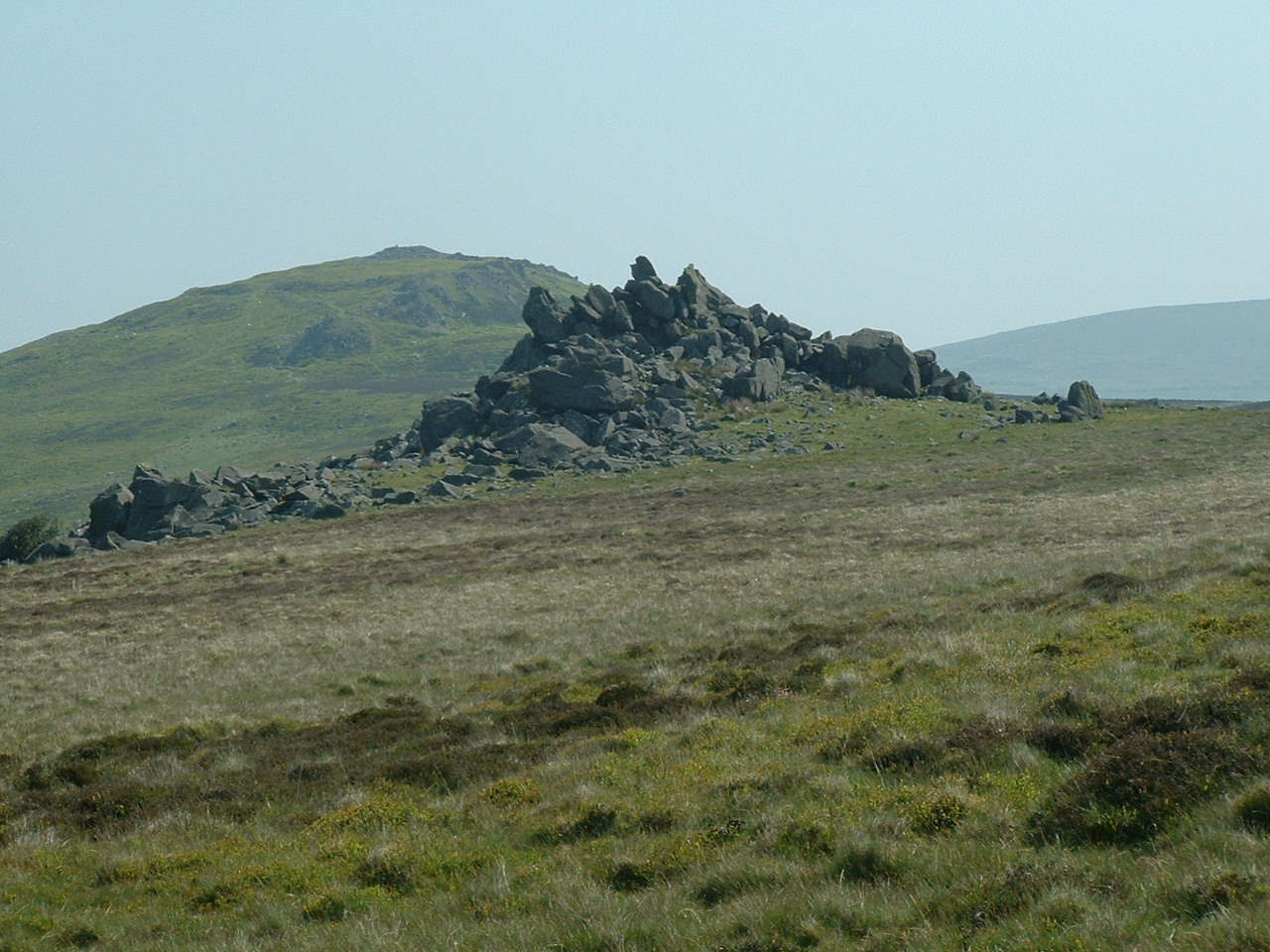
To what extent is Salisbury Plain a periglacial landscape, fashioned by frost-related processes during past glacial periods?  This question has received a fair bit of attention over the years, and the assumption has always been that this rolling chalk downland has NEVER been directly affected by glacier ice.  Geologists and geomorphologists including James Scourse and Chris Green have even gone so far as to say that it was IMPOSSIBLE for glacier ice to have extended this far into the interior of Southern England.  As I have argued, it is certainly not impossible from a glaciological point of view, and indeed the isostatic history of the area (insofar as we can unravel it) does suggest deep depression and recovery inexplicable except in terms of an ice cover.   The strange assemblage of more than 30 different rock-types in the "bluestone" collection also argues for the glacial deposition of either an erratic train or fan, or even a layer of till, in the vicinity.

I have always been intrigued by the "clay-with-flints" puzzle, and have wondered whether this catch-all term has been used for genuine periglacial slope deposits, residues from Tertiary or other rocks that once capped the chalk, and for ancient and denuded glacial deposits.  From the descriptions, it does seem rather variable.

Click on the title above to go to a previous post, from 9 Dec 2009.

Anyway, in an attempt to understand the history of Salisbury Plain a bit better, I came across these:


-------------------------------------------------

(1)  Devensian periglacial influences on the development of spatially variable permeability in the Chalk of southeast England
P. L. Younger
Quarterly Journal of Engineering Geology and Hydrogeology; 1989; v. 22; issue.4; p. 343-354


In unconfined parts of the Chalk aquifer in southeast England, permeability generally varies laterally with the lowest permeabilities occurring beneath interfluve areas, and the highest beneath river valleys and dry valleys. Furthermore, the Chalk in the river valleys is normally in excellent hydraulic continuity with the overlying highly permeable Quaternary gravels. However, recent field investigations in the Thames Valley have demonstrated the existence of zones of anomalously low Chalk permeability associated with the development of thin discontinuous confining layers of low permeability ‘putty chalk’ at the gravel-chalk interface. Hitherto putty chalk in the Middle Thames Valley has mostly been reported from interfluve areas where it can occur as a periglacially frost-weathered mantle on the upper surface of the Chalk. The true extent and hydraulic significance of putty chalk in valley bottom positions is only now being realised. Existing models for the lateral variation in Chalk permeability cannot explain these new observations. A new model is therefore proposed in which it is envisaged that, during the Devensian, carbonate dissolution in perennial taliks (unfrozen zones) beneath the major channels of the braided palaeo-Thames caused the high-permeability zones, while permafrost beneath the interfluves restricted dissolution at those sites. Freeze-thaw action in seasonal taliks beneath minor channels would account for the formation of putty chalk at the gravel-chalk interface, and the persistence of permafrost beneath these seasonal taliks would lead to a restriction of dissolution, and thus to a zone of low permeability.

------------------------
(2)  Anon:    Environmental Statement -- Stonehenge Visitor centre -- Geology and Soils

9.3.1 The 1:50,000 Geological Survey Sheet 298 indicates the site to be underlain by Upper Chalk
of Cretaceous age. Along the southern and eastern sides of the site deposits of Valley Gravel
and Alluvium associated with the River Avon are indicated to be present.
9.3.2 The Upper Chalk comprises weak white fine grained limestone composed almost entirely of
foraminifra. Due to its weak/soft nature the Chalk is easily weathered and can range between
completely re-worked soil composed of chalk fragments to structured chalk rock. There are
also frequent bands of flints within the Chalk.
9.3.3 The valley gravels lie beneath the Alluvium and extend further up the valley sides and
represent river deposits of earlier times when the river was much larger. The Valley Gravels
generally comprise sandy gravels and gravelly sands including much reworked chalk and flint
in this area. In addition the valley gravels can vary significantly over short distances both
horizontally and vertically.
9.3.4 Alluvium is associated with the present river course and is typically highly variable in
composition ranging between gravels and clays often with organic matter and lenses of peat.
9.3.5 Often above the Chalk there is a thin cover of clay with flints which tend to mantle the
slightly uneven upper weathered surface of the Chalk. This material typically comprises
brown silty and sandy clays with abundant sub-angular to sub-rounded gravel and cobbles of
mostly flint.
9.3.6 The Chalk is a major aquifer and groundwater flows through the Chalk via interconnecting
fractures. It is likely that at this location there is direct continuity between groundwater in the
Chalk and the River Avon.

Geophysical Characteristics

9.3.7 Results of the geophysical survey are shown in Figures 9.1 to 9.4. The survey clearly shows
the area of a former borrow pit which was earlier identified by the archaeological magnetic
survey. The anomaly related to the borrow pit shows as a broad low resistivity area. The
shape of the resistivity anomaly related to the borrow pit is similar to that provided by the
magnetic survey.
9.3.8 The areas outside the borrow pit are divided into two zones. These are broad linear zones of
either relatively constant resistivity or zones characterised by rapidly varying resistivity in
which a number of enclosed oval or irregular resistivity anomalies are present.
9.3.9 These zones are most strongly differentiated at around 5m depth and generally reduce with
depth.
9.3.10 These zones of varying resistivity anomalies correspond to areas of deeper superficial
material identified by the physical investigation.
9.3.11 It is considered that these zones represent probably structurally controlled areas of enhanced
surface and subsurface solutioning which can be referred to as examples of doline fields.
Such features are common in areas of limestone (of which chalk is a type) which have
undergone solutional weathering or karstification. The lineation of these zones is clearly
identifiable as E-W to ENE-WSW. This trend is compatible with the tectonic discontinuity
patterns in the area.
9.3.12 Doline formation in the Chalk has been attributed to a number of mechanisms and different
shapes of features are possible. Common conical shaped rapidly tapering forms are
attributable to authigenic (A-type) solutioning where solution is carried out by rain falling
directly onto the chalk surface. Elongate forms are more common with allogenic (B-type)
solutioning by streams forming on the adjacent impermeable cover material and sinking as
they cross the boundary of the chalk.
9.3.13 A mixed mechanism of solutioning and modification under periglacial conditions has been
proposed by P. L. Younger in Devesian Periglacial Influences on development of Spatially
Variable Permeability in the Chalk of South East England (QJEG Vol 22 No 4 1989) for
forms which show a very tabular shape and broad flat base which are also common in the
South East. The base of these features has been related to the depth of permafrost and may
be up to 15m deep.
9.3.14 The depth of the base of the features found on the site is generally less than 5m although PH6
superficial material was encountered to a depth of about 8m. The base of a solution feature
was encountered in trial pit 4 at about 2.5m depth as a broad flattish base. This observation is
consistent with periglacial modification.
9.3.15 C. L. Edmonds in Towards the Prediction of Subsidence Risk on the Chalk Outcrop (QJEG
Vol 16 1983), has indicated that there is a low density of solution features on the Chalk of
Salisbury Plain. This observation has been queried on the basis that the low density of
development on the Plain compared with other Chalk areas has not afforded the same
opportunity for the discovery of solution features. It is also likely that variations in solution
feature density are possible on any area of chalk where differences of geology and structure
exist. Mixed A and B-type development is possible.
9.3.16 Edmonds (op.cit) suggests that this lack of solution features may be related to the Plain
having had much of its surface removed during the late glaciation. This suggestion is
consistent with the base of the periglacially modified solution features in general being less
than would be expected from P. L. Younger (op.cit) had a significant depth of surface been
removed subsequent to periglacial modification.
9.3.17 In areas outside the zones of significant anomalies small purely solutional pipes were evident
at the clay/chalk junction.
9.3.21 The chemistry of the groundwater has been analysed in one sample obtained from BH8. The
results of this indicate that the water has a pH value of 6.7 a temperature of 16.2°C,
conductivity of 780μS/cm a total hardness of 338mg/l and a saturation of -42mg/l.
9.3.22 In consideration of these results the temperature of the groundwater at this location was
unexpectedly high. In addition the water was undersaturated (-42mg/l Ca CO3). Borehole 8
from which the sample was obtained was within the borrow pit and it is likely there is a
pathway for surface water to travel to the groundwater easily in this area as the less pervious
9.3.18 A proposed model for karstification and subsequent modification is shown in Figure 9.5.
This shows the possible landscape changes since the later stages of the present glaciation. It
should be noted that the model is schematic and that no absolute time frame over which the
changes have occurred is implied. The model is however, consistent with published
variations in karstification known from other areas. Present day or more recent solution
activity is indicated by the development of small scale, A-type solution pipes present across
the investigation area.

Monday 13 December 2010

Periglacial effects on Salisbury Plain

I came across Mike Parker Pearson's references to those strange "grooves" or "striations" in the surface of the chalk, discovered during the Bluehenge excavations.  They were blithely described as "periglacial" -- but I would dearly like to know more about them.  On the matter of the lowering of the ground surface during Pleistocene / Holocene times, I also discovered this interesting little piece on the Geol Soc web site -- to whom acknowledgement is due.
 

Q: I am trying to ascertain the effect of acid rain on Salisbury Plain - particularly the loss of ground levels as the chalk dissolves. Is there anyone who can give me a rough estimate of the amount of ground level loss since the Neolithic period?

From Mr John Drews (August 2009)


Reply by Prof. Rory Mortimore

A simple question with a difficult answer! Yes dissolving of the Chalk happens all the time as we know from the “hard” water we get in areas taking their supply from it. How much this dissolving process has actually lowered the Chalk landscape is questionable.

For me, the most telling evidence is the fact that everywhere we dig into the Chalk with trial pits and boreholes (e.g. for the A303 investigations around Stonehenge and Winterborne Stoke on the south side of Salisbury Plain and quarry exposures around the edge of Salisbury Plain at Westbury, Stoke Hill etc.) we find weathering structures created during the last Ice Age – features typical of the frozen ground around the fringes of ice sheets. These are called “periglacial” weathering features.

The periglacially degraded top layer of Chalk, and the underlying periglacial fracture patterns, are hardly disturbed from the time they were produced - most probably during and at the end of the last major cold period 14-12 k yrs ago (with two “mini” ice ages since). Similarly, the downslope wasting of periglacial material by the action of freeze-thaw, solifluction (soil creep) and meltwater indicates that most of the landscape predates the last major cold period and is, therefore, much older than the Neolithic (New Stone Age – beginning c. 9500 BCE).

Over the last 12,000 years dissolving the Chalk by rainfall or groundwater flow in the Chalk has enhanced “karstic” features (landforms caused by dissolution of soluble limestone rocks) in some areas and we know where there are areas of active karst today, leading to ground collapse. These areas are in special geological settings (e.g. along feather edges of Palaeogene deposits on the Chalk in particular tectonic settings) and are the result of localised processes.

There is therefore no current evidence to show large-scale downwasting of the Chalk landscape by acid rain.

Despite all this work I cannot find reliable figures illustrating the quantity of dissolved ‘chalk’ entering rivers and supply networks (most of this dissolution would come from fissures etc rather than the near ground surface chalk, so it would not lower the landscape significantly). Unlike coastal cliffs, where it is possible to measure the retreat over time and see at first hand the processes involved, we do not have the same control on the general inland landscape of the Downs and Salisbury Plain. The era of satellite surveying techniques may change this.

Further reading


This list of references is not comprehensive – indicative only.

See Sparks 1960 page 160 in a summary of previous work up to that time, discussing rainfall and/or humic acid as a dissolving process and Price, Downing & Edmunds, 1993, p.49-50 on the evolution of acidic groundwater in the Chalk: there have been many other studies on Chalk landscape evolution since Sparks including the Soil Survey (Catt, 1986; Hodgson et al., 1967, 1974); DKC Jones (1971;1999) and studies of the hydrogeochemistry of the Chalk groundwaters (the most comprehensive data set is in the British Geological Survey publication, The Chalk aquifer of the South Downs, 1999 pages 55-63; and good discussions in Price, Downing & Edmunds, 1993.

  • J.A. Catt. 1986. The nature, origin and geomorphological significance of clay-with-flints. The scientific study of flint and chert: Proceedings of the Fourth International Flint Symposium, Brighton, April, 1983. In: G. De G. Sieveking & M.B. Hart Eds. Cambridge University Press.
  • R.A. Downing, M. Price & G.P. Jones. 1993. The Hydrogeology of the Chalk of North-West Europe. Oxford Science Publications. Clarendon Press.
  • J.A. Hodgson, J.H. Rayner & J.A. Catt. 1974. The geomorphological significance of Clay-with-flints on the South Downs. Transactions of the Institute of British Geographers, 61, 119-129.
  • D.K.C. Jones. 1971. Southeast and Southern England. Methuen: London.
  • D.K.C. Jones. 1999.
  • H.K.Jones & N.S. Robins (Eds). 1999. The Chalk aquifer of the South Downs. Keyworth, Nottingham, British Geological Survey
  • Price, R.A. Downing & W.M. Edmunds. 1993. The Chalk as an aquifer. In: R.A. Downing, M. Price & G.P. Jones. 1993. The Hydrogeology of the Chalk of North-West Europe. Oxford Science Publications. Clarendon Press. Pp. 35-58.
  • B.W. Sparks 1960. Geomorphology. Longmans.

Glacier retreat and pressure release

I was zooming around on Google Earth the other day when I was reminded of the fantastic piece of "collapsed coastline" between Newport and Ceibwr on the North Pembrokeshire coast.  This piece of coast was invaded by ice coming in from the sea, from the NW, exerting great compressive stress on the old cliffline.  Here the rocks are quite soft, made up of shales and dark mudstones -- but rock is very strong when under compression.  But when, at the end of the Devensian, the glacier ice melted away in Cardigan Bay, suddenly the compressive stress was removed, and the response of this whole stretch of coastline was to collapse in a series of linked slips and landslides.  This is still happening today, with fresh landslides caused by slight undercutting at the base of the cliff by wave action.  The slips are cutting back into the land every year, causing the National Park to reroute the Pembrokeshire Coast Path further and further inland......

I have always referred to these landslides as "pressure release landslides" because they remind me of even bigger landslides in NW Iceland, where much stonger rocks (basalts etc) have collapsed in a very spectacular fashion following removal of glacier ice at the end of the last glaciation.

Sunday 12 December 2010

Pitts pours scorn on Woodhenge reconstructions


In the Daily Mail Mike Pitts has had a go at the Woodhenge story that emerged in the summer on the basis of a radar / magnetometry scan of the site -- and which led to rather fanciful reconstructions of a circle of massive posts by Prof Gaffney and colleagues.  Pitts now thinks that the "circle" of post holes was not prehistoric at all -- but simply a collection of holes maybe a hundred years old, put up for posts and a fence around the central mound, intended to protect it from cattle and human interference........

Gaffney says that post-holes for fences are never 3 ft wide and 3 feet deep, and that the pits shown up in his survey must have been for poles about the size of telegraph poles.  Nonsense.  I have very often had to dig holes over 2 ft wide for quite modest fencing posts -- and have seen the sides collapsing when the holes are filled in again with the posts installed. The "footprints" would be about the same size as the Woodhenge post holes.  

It's quite encouraging to discover that archaeologists are apparently not capable of telling whether a collection of holes in the ground is less than a century old, or 1000 years old, or 5,000, or whatever............

Long live incompetence!

http://www.dailymail.co.uk/sciencetech/article-1337890/Woodhenge-Is-greatest-discoveries-archaeology--simple-farmers-fence.html#ixzz1Dj4rwwBM

Woodhenge: Is this one of the greatest discoveries of archaeology...or a simple farmer's fence?

Read more: http://www.dailymail.co.uk/sciencetech/article-1337890/Woodhenge-Is-greatest-discoveries-archaeology--simple-farmers-fence.html#ixzz17udo6xdj
................ Mike Pitts, editor of the magazine British Archaeology and an acknowledged expert on Stonehenge, said he had been prompted to study maps of the area after receiving a letter from an American reader.
In the spot where Prof Gaffney had claimed to have uncovered his post holes, Mr Pitts said he and colleagues examined a Seventies Ordnance Survey map – and saw a fence marked out.
He thought it probably was an early 20th Century construction, erected by the then Government’s Office of Works or a local farmer to protect what was thought to have been the most important site in a cluster of burial mounds that were ancient but later than Stonehenge.
Mr Pitts said: ‘Vince Gaffney says his discovery encircles a burial mound within its circumference, but unless he has some unpublished material to substantiate his discovery, I am in no doubt that this was a modern fence line.
‘If I’m right then the post holes contained modern fencing stakes and they are actually in a hexagonal shape, not a circle.’
He added: ‘I think that perhaps what has happened is that the professor’s field workers have presented him with the wrong picture and he’s shot from the hip and made an over-hasty announcement. He’s generally known for the high quality of his work and his enthusiasm which, on this occasion, may have let him down.
‘The full publication of his results and small-scale excavations of the site would clinch the matter.’

Saturday 11 December 2010

Profs miss out on Counterknowledge award......

Acknowledgement:  BS Historian
http://bshistorian.wordpress.com/2008/09/28/stonehenge-snake-oil/

How did I miss this one?   Sadly, in the event, Profs Wainwright and Darvill missed out on this award, having got less than 1% of the vote.  The 2008 winner was Prince Charles.  Well, no doubt the BBC is working with the two senior archaeologists as we speak, with a view to making a bigger and better TV spectacular for future transmission.  Perhaps, when that programme goes out, the two Profs will be in with a much better chance of winning this prestigious award.  It is, so I understand, even more hotly disputed than the Bad Sex Award for which novelists so manfully strive every year......

Discussing the Darvill / Wainwright work, Counterknowledge said:
Actually, this is not so much “revolutionary stuff” as guesswork. And it’s true that reputable academics often have to guess, to follow their hunches, in order to make a breakthrough. But there something about the insistent tone adopted by Wainwright and Darvill, heavily flavoured with wishful thinking, that reminds me more of Baigent and Leigh than mainstream archaeology. And don’t forget that this conveniently colourful theory is linked to a TV series and book.
Thanks to cunning and unscrupulous cult archaeologists, respectable researchers now find themselves under pressure to dress up their discoveries in commercially appealing garb. “Prehistoric Lourdes” has a nice ring to it – but is there any truth in the theory? 
http://www.bbc.co.uk/history/programmes/stonehenge/article1.shtml

Stonehenge unhinged.

http://bshistorian.wordpress.com/2008/11/24/stonehenge-unhinged/

By bshistorian
Just a quick update to a previous post, thanks to my recent (well behind the times) discovery of the rather awesome website (and book) Counterknowledge.com. Turns out they came to similar conclusions on this one, back in April, well before the Timewatch programme that caught my attention. More recently they posted news from the main competing team of archaeologists that actively debunks this stuff. Best of all, the Stonehenge healing “hypothesis” has made it into their nominations for the Counter Knowledge Award 2008! Nice one chaps, although I have to say that’s some pretty stiff competition they’re up against… if anyone’s thinking of voting for this, bear in mind that all of the others have prior form, and they aren’t professionals in their field. These guys are, which is what makes this story so unusual.

2008 Counterknowledge Awards -- nomination
http://counterknowledge.com/2008/11/vote-now-in-the-2008-counterknowledge-awards/

Tim Darvill & Geoff Wainwright
Way back in April, we said there was something fishy about Darvill and Wainwright’s theory – unveiled in a BBC documentary – that Stonehenge was intended as a stone-age Lourdes. Sure enough, in October of this year, the experts agreed. Programme commissioners, take note: this is what happens when you set out to turn archaeology into tabloid headlines.

Friday 10 December 2010

Calculating isostatic loading and rebound

This is one of the BRITICE models, for which I thank Dr Alun Hubbard and colleagues.  I'm posting it here because it has a bearing on the discussion on this blog about isostatic loading and rebound during the Devensian and other glaciations.  This model shows calculated ice thicknesses -- if you click on it to enlarge, and then examine it carefully, you will see that the THICKEST ice was off the NE coast of Scotland, whereas over the west coast of Scotland, which is maybe where the highest part of the ice dome was located, the high mountain terrain means that in many places the ice was less than 500m thick.  Another area of very thick ice was in the Irish Sea basin, centred on the Isle of Man.

The general rule, ie that 1,000m of ice leads to about 330m of crustal depression, is VERY difficult to apply in such circumstances.  If you were to try to draw a map of isobases -- showing lines of equal isostatic depression -- it would be incredibly difficult to get it right, since elastic effects, crustal warping (influenced by local geology) and regional tectonic trends also come into play.  Then in those areas where the sea is flooding back in, 100m of potential isostatic recovery may convert to less than 70m, because a water column will take the place of an ice column.  I don't think we are yet anywhere near getting an accurate isobase map for the UK.  But we have to try, because I think this area of research is crucial in understanding coastal sediment sequences, the history of Doggerland etc.

Bluestone fever hits Japan


Those good ol' healin' bluestones.... what would we do without 'em?

A company that makes silver jewellery containing pieces of "bluestone" (for which read "dolerite") is making rather lavish predictions that it will sell £10 million-worth of its products in Japan next year, on the basis that the rock has healing or sacred properties.  Well, best of luck to Colin Shearing and his colleagues, and all credit to them for as fine a piece of marketing hype as you are ever likely to see.  It's a tough old business world out there........

But I wish we could have a bit less of the pseudo-science.  Quote: "A  huge demand for “healing” stones from the Welsh mountains that provided the rocks for Stonehenge......"  Hmmm.  For that read "some of the rocks for some of Stonehenge..."
 Quote:  "...cut from the same hills as the rocks of the ancient Wiltshire monument."   Hmmm.  Repeat something often enough and somebody might think it's actually true.
Quote: "... pieces of the local Welsh bluestone – the same as was used to make Stonehenge 5,000 years ago –...."   Hmmm......What was I just saying?
Quote from Colin Shearing: "....they see the stones in the same way as the ancient druids did."  Pardon me, but where did that piece of codswallop come from?  Never mind -- I suppose nobody can prove you wrong!
Quote:  "Mr Shearing heard that the last remaining working quarry for the stone was being closed – and bought the exclusive rights to extract the remaining rocks."  It looks as if the marketing effort is directed at SPOTTED dolerite -- but as far as I know there  never was a working spotted dolerite quarry in North Pembs, and to talk about "exclusive rights" and "the remaining rocks" to maintain the pretence that dolerite is a rare and disappearing asset is truly wonderful!

Quote from Geoff Wainwright:  ".....the so-called healing quality attributed to Preseli bluestone can be traced as far back as the Stone Age. The bluestones came from a crag of rock called Carn Menyn. That rock is surrounded by spring water which has been recognised as a medicinal spring for centuries. We found that they were venerated in prehistoric times and clearly, in our opinion, thought medicinal even then.”  Sorry folks.  Total garbled nonsense from beginning to end, as I have laboriously explained before.

"But we don't want the truth to get in the way of a good marketing opportunity, do we?" as the man from English Heritage probably said.


----------------------------------------------------------------------
‘Healing’ gems from Wales a hit in Japan
 

Dec 10 2010 by Sion Morgan, Western Mail

A HUGE demand for “healing” stones from the Welsh mountains that provided the rocks for Stonehenge could generate millions of pounds thanks to a deal struck with the superstitious Japanese market.

Jewellery business Preseli Bluestone International has seen sales rocket thanks to new distribution arrangements in Asia for their products, which are cut from the same hills as the rocks of the ancient Wiltshire monument.

“At the moment the stones are the fastest selling product of their kind in Japan,” company founder Colin Shearing said.


“The people are going crazy for them and I think it is because they see the stones in the same was as the ancient druids did.

“The Japanese are obsessed with lucky numbers, lucky colours, lucky charms. To them these stone hold a mystical power – we are not just seeing people out there wearing them as a fashion item, we are seeing businessmen wearing them to bring them luck in the running of their companies.”

Mr Shearing began trading after a chance meeting with an elderly sculptor he met while living in Preseli 10 years ago.

The landscape artist and former theatre director set up Preseli Bluestone International after seeing the sculptor carving pieces of the local Welsh bluestone – the same as was used to make Stonehenge 5,000 years ago – and wondering what else could be done with the stone.

Mr Shearing heard that the last remaining working quarry for the stone was being closed – and bought the exclusive rights to extract the remaining rocks. Since then the business, now based in Oxfordshire, has operated as “more or less a cottage industry”, selling its jewellery online and through the English Heritage shop at Stonehenge.

But a recent approach from a Japanese distributor has changed all that.

According to archaeologist Geoffrey Wainwright, president of the Society of Antiquaries, the so-called healing quality attributed to Preseli bluestone can be traced as far back as the Stone Age. “The bluestones came from a crag of rock called Carn Menyn,” he said. “That rock is surrounded by spring water which has been recognised as a medicinal spring for centuries.

“We found that they were venerated in prehistoric times and clearly, in our opinion, thought medicinal even then.”

After a meeting in Tokyo, Mr Shearing has agreed a contract to supply more products made from the stone every month for the next three years at least. The range has also attracted interest from South Korea, a potentially huge market, which will be handled by the company’s Japanese partner. The partner predicts it will do £10m worth of business with the products in Japan alone next year, meaning a potential 40% increase in business.

Designer Rhiannon Evans owner of the jewellery business Rhiannon, based in Tregaron, produces a number of pieces for Preseli Bluestone International.

“It is another example, like Welsh gold, of a product which is made in Wales, by Welsh designers, using a Welsh product,” she said. “That is the thing that makes it so special.”

Read More http://www.walesonline.co.uk/news/wales-news/2010/12/10/healing-gems-from-wales-a-hit-in-japan-91466-27800788/#ixzz17iSKdjbb

Tuesday 7 December 2010

Doggerland

In recent posts we have been looking at the west and south of the UK, and trying to work out how eustatic and isostatic factors might have combined to create the features that we can recognize today -- either in the landscape or in sediment sequences.

But what about the east, and the area now submerged beneath the North Sea?  Can we learn anything from the Holocene history of this area that might help us to reconstruct the events before, during and after the Anglian Glaciation?
Above is a pseudo-satellite image of what the landscape might have looked like c 10,000 years ago.  Then comes the following sequence, with reconstructions for c 9,000 BP and 7,000 BP, showing a gradual marine transgression linked to the Holocene sea-level rise:

Acknowledgement to BJ Coles and SE Rouillard and others.  There is considerable doubt about where these shorelines were at particular dates BP, for the obvious reason that the evidence is somewhat difficult to get at!  Bones and artifacts dating from the Palaeolithic and the Mesolithic have been dragged up from the bottom, for the most part in trawl nets.  The highest part of the Dogger Bank today is about 15m below current sea-level, and Gaffney and various others have suggested that the final submergence of the highest point in this lost landscape occurred after Mesolithic times, maybe around 6,000 years ago.  (Some authorities think that the submergence was earlier, around 8,500 years BP.)  If the final submergence was around 6,000 BP,  sea-level will have been maybe 6 - 8 m lower than it is today.  The subsequent deeper submergence of most of this lost landscape is ascribed to the gradual isostatic depression of the North Sea Basin at a rate of maybe 1m per millennium.

This all sounds logical enough, but what interests me is the matter of glacio-isostatic depression associated with the Devensian glaciation.  None of the above maps take any account of isostatic factors, and that is a major defect in the theory.  If we are to believe the maps showing the extent of Devensian glacier ice over the UK, then at least a part (and maybe all) of Doggerland would have been glaciated around 20,000 years ago, with substantial isostatic depression of the crust in the North Sea basin.  So did the sea flood right in across this depressed area when the ice melted away, to become dry land again later as isostatic uplift rates outstripped eustatic sea-level rise rates? 

Interesting questions, still to be answered.  In the drill holes put down by the oil companies during their oil explorations, I wonder if there is a layer of marine sediments BENEATH the soils, peats and other sediments associated with the mysterious lost land of Doggerland?

Crazy glaciers slug it out.....

This has nothing whatsoever to do with Stonehenge, but it is one of my favourite glacier pictures.  From east Greenland, courtesy Google Earth.  Big glaciers and little glaciers, struggling for supremacy in a rectilinear pattern of troughs.  Absolute mayhem!  But notice that the big glaciers are always the ones who win....

Click for a larger view.

Salisbury Plain ice edge?


If the ice of the Irish Sea Glacier really did extend into eastern Somerset or even onto the chalk lands of Salisbury Plain, what did the ice margin look like?  My own instinct is that it was a vertical ice front (I know Kostas is going to love this!!) rather like that which we find in the high arctic parts of Greenland, where the ice is very cold and the climate is also cold and arid.  The two pictures above are typical for the ice front where it sits on an undulating land surface to the east of Nares Sound and eastwards into Peary Land.

There are some dirt layers in the ice, and some shearing, as we can see at the right hand edge of the lower photo -- but the ice is moving very slowly indeed, and this is a very different sort of environment from that which we see near the snouts of rapidly moving and rapidly disintegrating glaciers.

Why do I think these are reasonable analogies?   Well, the apparent lack of any thick layer of anything we might call till on Salisbury Plain; the signs of permafrost and periglacial action on the chalklands, the permeable nature of the chalk, which would in itself inhibit movement on the glacier bed with meltwater lubrication; and the fact that we are on the lee side of an extensive ice sheet, where precipitation and ice dynamism would have been much less than on the western or Irish flank.

And I don't think that the ice was here for very long.  If there had been a more or less static ice margin here for centuries or even millennia, there would have been a substantial morainic feature left behind afterwards, even if the ice was moving very slowly.

Needs more thought.....