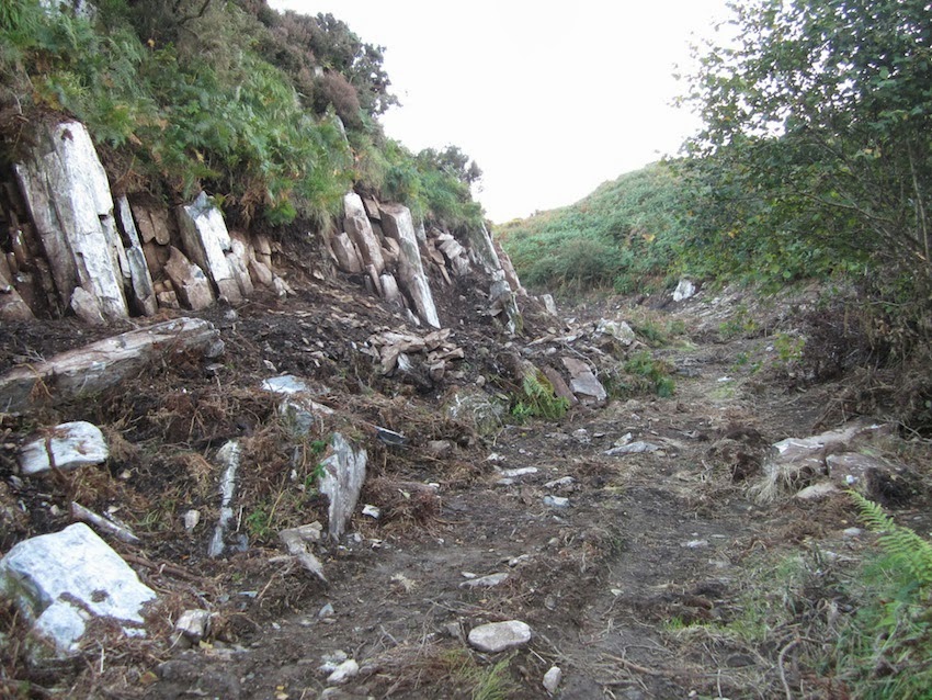
Poulnabrone dolmen – 5,000 year old portal tomb in the limestone Burren area of
County Clare, Ireland
This is a very interesting article from Heritage daily. Worth reproducing and reading.....
Significance of Megalithic Monuments in Atlantic Europe?
Ashleigh Murszewski
Posted by:
HeritageDaily , September 15, 2013
An archaeologists analysis on how the construction of megalithic monuments in Atlantic Europe are not restricted to a single purpose, nor how they reflect one aspect of the community that built them.
Contrarily, they give well-rounded evidence for practical and symbolic components of the early agricultural lifestyle within the Neolithic. Depictions in the architecture of these structures explore complex symbolism and the socio-ritual interactions where monuments offer places for gatherings. Furthermore, megaliths demonstrate understandings of geometrical and astronomical knowledge in society that was not thought to be established for centuries.
Megalithic monuments of Atlantic Europe have long attracted attention from those who are interested in the early past of mankind. The word megalith originates from the Greek, meaning ‘great stone’ and is used when describing stone structures set upright in the Earth dated from 5000 to 500 BC in Atlantic Europe (Balter, 1993).
These massive stone structures consist of some of the most famous and visually spectacular archaeological discoveries in the world and signify extensive technical ingenuity and organisation that would be essential to their construction. Their significance is also connected with the development and establishment of the first farming communities in the Neolithic, where their craftsmanship reflects the establishment of territorialism and community identity.
These monuments signify the elaborate transformation in response to the changing demographic and social reorganisation within these agricultural communities. At this level of socio-political complexity, monumental architecture also becomes an integral part of distinguishing the upper classes from the lower ones (Trigger, 1990). Megaliths are also imbued with symbolic and astronomical meanings, which embody both physical and conceptual philosophies about the nature of the world that was inhabited by early agricultural communities. Therefore, their significance is not only a marker of the development of community reorganisation, but reflects a greater connection with the universe and the spiritual realm.
Monumental architecture was one of Gordon Childe’s criteria of urban civilisation, where monumental building is still employed by archaeologists as an index of the development of social complexity (Scarre, 2002). He argued that the whole European megalithic phenomenon was an indirect reflection of travelling bands of missionaries along the Atlantic coastlines (Sherratt, 1990). Starting in the Mediterrean, he imagined groups of sailors travelling northwards along the Atlantic coast bringing a new religion and the monumental settings that it demanded (MacKie, 1977).
Therefore, he assumed more of an outward spread of megalithic builders from a more developed region like the Mediterranean. Although later radiocarbon chronologies have severed Childe’s diffusionist link, megaliths remain highly important when understanding early forms of social organisation and territorial perception in relation to the surrounding landscape (Sherratt, 1990; Thomas, 1988). With the minimal evidence for farming within the Mesolithic, monuments have been seen as a monument that has been linked to the development of farming within the northwest of Europe (Chapman, 1981; Rowley-Conwy, 2011). The areas under consideration here include western France, Britain, northern Germany and Poland and southern Scandinavia (Sherrat, 1990).
To compare, if we were to look at Central Europe, native groups were associated with more easily transmissible features such as livestock, pottery and cereal cultivation to produce characteristic village patterns (Sherratt, 1990; Thomas, 1988). Here, the spread of horticulture to a new ecological setting was directly associated with the development of nucleated, timber village structures and community structure (Rodder, 1984, p. 51). In addition, cemeteries and earth-built structures are not uncommon within central Europe; where their association with monumental burials rarely exists.
On the western and northern margins of Europe, cereal cultivation is favourably correlated with megaliths and monumental surrogates (Rodder, 1984, p. 51;Sherratt, 1990). The dominance of these megaliths in its place of timber villages is not simply due to the absence of raw materials in specific regions. It can be, therefore, argued that these tombs were a basic feature of early cereal cultivation, where the material infrastructure and the organisation of labour are crucial to the establishment of horticulture (Thomas, 1988).
The construction of megalithic monuments also signifies a level of permanence or sedentary lifestyle within the region. Renfrew (1981) argues that megalithic monuments are not only associated with agriculture, but reflects community establishment that signifies the presence or territorial ownership.
This is understood through the immigrant Neolithic societies of central Europe where village communities consisted of residential units and longhouses, whose construction was directly related to the co-operation of several households (Sherratt, 1990). Likewise in Western Europe, the development of farming would have produced similar alterations in society necessitating radial communal organisation. However, in order to reproduce this social mechanism in the absence of large, stable residential units required the manufacture of some equivalent formal mark of unity (Hodder, 1984; Renfrew, 1981).
The development of monumental tombs was the surrogate for the living and acted as a permanent house of the dead amongst the insubstantial huts dispersed throughout the Western Europe (Sherratt, 1990). Furthermore, the level of effort and consideration that went into the craftsmanship of these monuments reflect the importance of these structures within their community, where monuments mark a meaningful place where people divide up the countryside as far as ritual and symbolic activities.
Therefore, they are thought to have an intense occupation period and served their communities for many generations, acting as the burial places for the founding ancestors, communal ossuaries and as a continuing focus for ritual (Sherratt, 1990).
The majority of megalithic monuments in Atlantic Europe are associated with multiple or individual burial grounds in the form of communal tombs (Bradley, 1998). The level of effort that has been exerted in the manufacture of such monuments reflects their significance or in turn, the importance of ritualistic and symbolic behaviour within society.
In particular, passage graves established in Iberia, Ireland and Brittany probably went through several stages of development, where the earliest would have been smaller simple structures (MacKie, 1977). Later developments saw the increase of confidence and skill levels, resulting in the organisation of elaborate and ambitious funerary sites. For example, it is estimated that the tomb of Quanterness needed over 7 000 man-hours of labour for its construction (Renfrew, 1983). Chambers also became more regular, occasionally more cruciform in plan, passages and mounds became larger and decorations emerged (Thomas, 1990).
Ireland has the greatest concentration of megalithic tombs, where these process discussed above emerged three massive tombs in the Boyne Valley Group: Knowth, Dowth and Newgrange (MacKie, 1977; Thomas, 1990; Sheridan, 1986). These Irish passage graves show a phenomenon with architectural similarities with those from Brittany and Iberia, although the pottery and other objects found in them are purely local typology (MacKie, 1977).
Entrance stone with megalithic art. Wiki Commons
In some tombs that have been excavated, there are also sharp contrasts in burial practices. For example, Carrowkeel and Loughcrew have passage graves where the cremated bones have formed a layer 15 centimetres thick on the floors of the chambers. It is believed that cremation was used over many generations, however thought to be adopted from the local Neolithic population (MacKie, 1977). These alterations in burial practices throughout Western Europe are indications of the religious and symbolic practices that were once practiced within these communities.
When analysing these monumental burials it is also possible to determine the social arrangement or presence of hierarchy within the community (Sheridan, 1985). It is most likely that any evidence for this would be within the burials themselves. However, one possible way to determine hierarchy, without the analysis of grave goods is to determine the effort and time taken to construct the tomb itself (Patton, 1993; Renfrew, 1981).
Renfrew (1981) explains this through the division of status seen in monuments of southern Britain; where Long Barrows represent a labour investment of 104 man-hours. Conversley, the two prime monuments such as Stonehenge and Silbury Hill suggest labour exceeding 107 man-hours. Although Renfrew’s theory so far is not a rigorous one, it shows that the most of these sites with more elaborate graves are heavily dispersed.
Furthermore, the presence of ‘collective’ tombs with multiple people buried in one place over a longer time period implies that there are already social groups existing within the population (Furholt, LuthJohannes & Muller, 2001; pp. 281). Behind these communal burials must lie groups of people whose membership or involvement is a necessary criterion in order to be buried there (Renfrew, 1981). Perhaps the more common way to determine social stratification within a social group is the presence of grave goods within the tombs. Grave goods are sparse within most megalithic tombs and even then only in the simplest forms (Renfrew, 1983; Sheridan, 1985).
These finds are generally restricted to pottery, polished stone axes and chipped stone tools (Furholt, LuthJohannes & Muller, 2001; pp. 277). This is supported by the grave goods found with jumbled bones found on the main floor chamber of the tomb of Quanterness. Although they were minimal, a few pieces of chipped flint; three polished stone knives and fragments of 34 pots (Renfrew, 1983).
The symbolic meanings locked within Megalithic structures are represented through internal and external components and the raw materials that were used to create them. Monumental architecture may be said to be full of contradictions, which relate to social and religious aspects of Neolithic cosmology (Midgely, 2008). Although it may not be obvious, there are elements within Megalithic structures that function both physically and symbolically.
Midgely 2010 contrasts the light of the exterior with the darkness of the interior, further juxtaposing the horizontal and vertical by describing the horizontally arranged dry stonewalling. Furthermore, the hard stone boulders contrast with softer materials such as the earth or clay used on the floor with the mounds contrasting the hard bones from the soft flesh (Midgely, 2010).
The significance of colours within megalithic monuments is uncertain, however signifies a mystical or symbolic relationship between colours and architecture of these structures. These have been argued to be among the earliest and most emphatic symbols, perhaps related to vivid interpretations of life on earth or afterlife (Birren, 1978). In particular, white is utilised in major structural elements including boulders, dry-stone walling, and burnt flint on the chamber floor or white sheets of bark inserted between slabs (Midgely, 2010).
In addition the western façade of Grønjægers Høj dolmen has red stones, which are contrasted dramatically with the white capstones covering the burial chamber (Midgely, 2008). The interpretation of colours may symbolise diverse human experiences and therefore can and offer a wider range of possible interpretations.
Grønjægers Høj : Wiki Commons
The multiple raw materials that were used when constructing these structures, some exotic and others relatively common suggest that the way people thought was merged with the construction of tombs. These raw materials were gathered and moulded into new shapes, representing life, death and rebirth, which were incorporated into a continuous cycle employed by future generations (Midgely, 2008).
Behavioural and social practices within social communities of the megalithic culture can also be interpreted through the analysis of art within monumental tombs. Furthermore, some of the art is also reflected in surviving artefacts, which allows their contexts to be further analysed. First, megalithic art is thought to trace a progression from a naturalistic approach to more abstract motifs, particularly in Brittany, relating to an obvious advancement in prehistoric society (Bradley, 1989). Secondly, it considers the continuation of abstract art through Boyne Valley, which later progressed into other media throughout the British Isles (Bradley, 1989).
These sequences in overlap to some extent which is therefore, once thought to reflect a smooth linkage between communities from those regions. In particular, there are multiple examples of art on upright stones (menhirs), but the greater part of artistic motifs is represented inside the burial chamber of megalithic tombs or in the passage that is thought to communicate with the spiritual world (Shee Twohig, I981). Like previously stated, the majority of this art is a reflection of naturalistic and more schematic depictions of axes, tools, ploughs, bows and arrows, and more controversially, the identification of boats (Bradley, 1989; Shee Twohig, I981).
These images may reflect a connection with clearing and working with the land, where the bows and possible boats may indicate the continued use of the natural landscape. In addition, both in the early tombs and on menhirs there are further symbols that most likely have anthropomorphic significance (Bradley, 1989). These images became more profound in later deposits where they generally became significantly larger and employed grander stones in their construction.
Art forms progressed into motifs that had a greater array of non-representational designs including entopic phenomena (Bradley, 1989). A clear representation of this progression to more elaborate art is identified in the decoration of Gavrinis, which identifies two distinct phases; the first comprises of bows, hafted arrows and an axe, whereas the second consists of axe-heads, anthropomorphic symbols and parallel curved lines with nested arcs and spirals (Bradley, 1989).
Decorated slabs from the Gavrinis passage (replica in Bougon Museum).
These motifs at Gavrinis show a strong correlation with decorated tombs from Newgrange and Knowth (Eogan, 1986; O’Kelly & O’Kelly, 1982). These correlations may reflect interactions between these different regions, giving rise to trade networks and interfaces from people of different communities. It is from this evidence that megalithic art supports the theory of territorialism, where society utilised art forms to reflect community. It is also through particular images that the elaboration of symbolic principles developed to reflect more abstract behaviour.
More recent studies show that these Megalithic monuments were not only used for sacred burial grounds and ritualistic purposes as they reflect a greater understanding of geometry and astronomy than previously believed. In particular, monuments where stones stand in circular features are thought to be of Late Neolithic/Early Bronze Age, reflecting a second great phase of megalith building from approximately 2500 to 1500 BC (MacKie, 1977).
Professor A. Thom has surveyed a large number of archaeological sites, which provided the basis where he deduced the existence of the Megalithic Yard (MY), Megalithic Geometry and Megalithic Astronomy (Thom, 1971). It has been suggested that these structures have been built around flattened circles and egg shapes where their perimeters always are constructed out of areas whose circles radii are systematically multiples of Megalithic Yards (Moir, Ruggles, & Norris, 1980). The discovery of this elaborate geometrical knowledge was previously thought to emerge much later in history within Greek lifestyle approximately 2000 years later (MacKie, 1977).
A sophisticated geometrical understanding is not the only quality that has been uncovered through the assessment of circular megaliths throughout Atlantic Europe (Bradley, 1993). Many of these structures through their arrangement portray an association with practical astronomical functions (Moir, Ruggles, & Norris, 1980; MaKie, 1977; Service & Bradbery, 1979); Thom, 1971).
This connection with astronomical features is believed to have started with observations between the tides, the Moon and the Sun (Thom, 1971; 1977). By tracking the movement of the Sun it would be theoretically possible to construct an accurate calendar. Likewise, although the lunar cycles are far more complex, it is possible for predictions to be made on the occurrence of solar eclipses, which would give power to religious leaders or prophets within these communities.
Many of these megalithic structures have been constructed in observing positions for watching the sun at the solstices and equinoxes or the moon at the limits of its more complex cycles of movements across a sky (MacKie, 1977). One primary example of this is the site of Ballochroy on the west Kintyre where the midsummer solstitial sun is seen on the slope towards where the largest stone is orientated (Thom, 1977; Thom & Thom, 1977). Another site more precise then Ballochroy is the site of Kintraw, where the sun just reappears momentarily in the notch to the right. However, perhaps the most important feature is seen after climbing the steep hill where an artificial platform showing a series of stones, which precisely reflects the equinoxes of the Sun’s declination (Thom & Thom, 1977).
The two largest Megalithic lunar observatories in Europe are those in Carnac and Stonehenge, which both operate in different principles. In Carnac, it is seen from a universal foresight from eight distant positions round it where the Moon rises or sets behind the stone at one or other of the standstills (Thom & Thom, 1977).
Stonehenge is dated around 2800 BC and has been extensively studied to illustrate lunar cycles. The construction of Stonehenge was undertaken in multiple stages, where the building stage labelled Phase 3-A brought about the spectacular monument that we see today (Service & Bradbery, 1979).
Each of the upright stones is evenly spaced around the circle and occupies the space of 1 rod; with each of the gaps in between is half a rod (MacKie, 1977). Thom argues that this arrangement closely fits into the geometrical schemes that have been superimposed over them, where true north clips the ends of two opposing stones. The strong correlation with these megalithic structures and astronomy reflects that their makers had a solid grasp with the nature of the tides, moon and the sun.
Within a thousand years of establishing themselves, the first farmers started to build megaliths in the most part of Western Europe. This strong association with the development of agricultural communities within Western Europe and the establishment of megaliths indicates that their construction was based on the radiation of social complexity and organisation within these communities. As most of these monuments are in the form of tombs or communal burial grounds with the presence of symbolic art forms, reflecting the importance of supernatural beliefs and ritualistic activities within society.
These tombs reflect art forms and symbolic portrayals that reflect a greater understanding of realities of life and the anomalous entities of the multi-dimensional universe. Furthermore, the foundations of geometrical and astronomical knowledge mirrored in their construction signifies an advancement that was not thought to have been made in society for another 2 000 years.
============================
Header Image : Poulnabrone dolmen – 5,000 year old portal tomb in the limestone Burren area of County Clare, Ireland
Written by Ashleigh Murszewski
HeritageDaily : Archaeology News : Archaeology Press Releases
References:
Rodder, I., 1984, ‘Burials, houses, women and men in the European Neolithic’ in Ideology, Power and Prehistory, eds. Miller, C. & Tilley, C., Cambridge University Press.
Rowley-Conwy, P., 2011, Westward Ho; The spread of Agriculture from Central Europe to the Atlantic, Current Anthropology, Vol. 52, Supplement 4, pp. 431- 451.
Service, A. & Bradbery, J., 1979, Megaliths and their Mysteries; the standing stones of Old Europe, Weidenfeld and Nicolson, London.
Scarre, C., 2002, Monuments and Landscape in Atlantic Europe: Perception and Society during the Neolithic and Early Bronze Age, Routledge, New York.
Shee Twohig, E. I981. The megalithic art of Western Europe. Oxford: Clarendon Press
Sheridan, A., 1985, Megaliths and Megalomania: An account, and interpretation, of the development of passage tombs in Ireland, The Journal of Irish Archaeology III, Vol. 3, pp. 17- 19.
Sheridan, A. 1986, Megaliths and megalomania: an account, and interpretation, of the development of passage graves in Ireland. Journal of Irish Archaeology, Vol. 3, pp. 17-30.
Sherratt, A., 1990, The Genesis of Megaliths: Monumentality, Ethnicity and Social Complexity in Neolithic North- West Europe, World Archaeology, Vol. 22, No. 2, Monuments and the Monumental pp. 147- 167.
Thom, A., 1971, Megalithic Lunar Observatories, Oxford University Press, Oxford.
Thom, A., 1977, Astronomical Significance of Prehistoric Monuments in Western Europe, Philosophical Transactions of the Royal Society of London, Vol. 276, pp. 149-156.
Thom, A & Thom, S., 1977, Megalithic Astronomy, Journal of Navigation, Vol. 30, Issue 1, pp 1 14.
Thomas, J. 1988. Neolithic explanations revisited: the Mesolithic-Neolithic transition in Britain and south Scandinavia. Proceedings of the Prehistoric Society, Vol. 54, pp. 59-66.
Thomas, J., 1990, Monuments from the inside: The Case of the Irish Megalithic Tombs, World Archaeology, Vol. 22, No. 2, Monuments and the Monumental pp. 168-178.
Trigger, B., 1990, Monumental Architecture: A Thermodynamic Explanation of Symbolic Behaviour, World Archaeology, Vol. 22, No. 2, pp. 119-132.significance of Megalithic Monuments in Atlantic Europe?